Beautiful Laya Lingshi Trek
This trek is considered to be one of the most picturesque treks to choose from in Bhutan. It takes 15 days, starting from the base of the ruins of the Drukgyal Dzong in Paro and ending in Punakha, the old capital of Bhutan. Occasional parts of the trek can be demanding while the greater part is moderately strenuous. You will be rewarded for your efforts by the magnificence of some of Bhutan’s highest peaks and passes, charming little hamlets in the wilderness, yak herders in their homes, ruins of old settlements, and perhaps rare sightings of some of the rarest animals on earth such as the Red Pandas, Blue Sheep, Snow Leopard and other wildlife. Accompanying you throughout this experience will be our trained and experienced guides, camp crew, and horses.
Trip Overview
- Day 01: Arrive Paro (By Druk Air)
- Day 02: Paro
- Day 03: Paro, Excursion to Taktsang Monastery
- Day 04: Paro Shana (Start of Trek)
- Day 05: Shana – Soi Thangthangka
- Day 06: Thangthangka – Jangothang
- Day 07: Jangothang (Halt)
- Day 08: Jangothang – Lingshi
- Day 09: Lingshi – Chebisa
- Day 10: Chebisa – Shomuthang
- Day 11: Shomuthang – Robluthang
- Day 12: Robluthang – Lemithang
- Day 13: Lemithang – Laya
- Day 14: Laya (Halt)
- Day 15: Laya – Koena
- Day 16: Koena – Gasa Tsachu
- Day 17: Gasa Tsachu – Goen Damji Punakha (End of the Trek)
- Day 18: Punakha – Thimphu
- Day 19: Thimphu – Paro
- Day 20: Paro – Airport
The flight into Paro on our national carrier, Druk Air, is a befitting introduction to the spectacular beauty of our country. In clear weather, magnificent views of the world’s highest peaks give way to the lush green Paro valley as you land. Your Bhutanese escort from Chhundu Travel will greet you on arrival, and then drive you the short distance to the Hotel.
Your journey into the Thunder Dragon kingdom will truly begin with a drive in the morning to the ruins of the Drukgyal Dzong, 16 km up the valley. The Dzong was built in 1647 by Zhabdrung Ngawang Namgyal, father and unifier of medieval Bhutan. It was destroyed by a fire, said to have accidently started from the embers of incense offerings. Since then, it remains in ruins, a lasting reminder of the great victories it was built to commemorate. Explore the ramparts as you walk around the ruins, and on a clear day experience an unforgettable view of Mt. Jhomolhari (7,314 m).Our next visit is Ta Dzong, an ancient watchtower, which now houses the National Museum. Below the museum is the Paro Rimpung Dzong, the center of civil and religious authority in this district. A short walk takes you to the base of the dzong and across a traditional cantilever bridge. A short distance further is one of the innumerable archery grounds. (Archery is the national sport of Bhutan). If we are lucky, we may catch a match in action.The evening ends with a walk through Paro’s main town.
Today will be an excursion to view the spectacular Taktsang (Tiger’s Nest) monastery. After breakfast, a short drive takes us to Satsam Chorten. From there, a trail climbs through beautiful pine forest and an occasional cluster of fluttering prayer flags. We will stop for light refreshments at the Taktsang Jakhang (cafeteria) from where we can see, clearly and seemingly within reach, the breathtaking Taktsang monastery. Built in the 1600s, the monastery clings to the edge of a cliff that plunges 900 m into the valley below. Legend has it that Guru Rimpoche, the tantric mystic who brought Buddhism to Bhutan, landed here on the back of a flying tigress. Experiencing the special atmosphere and the backdrop of the monastery, flying tigers do not seem so unlikely after all. Lunch will be served at the cafeteria. The trek up and back will take up most of our day.
Our trek to Shana starts at the ruins of the Drukgyal Dzong. The trek follows the Paro river upstream. We will pass through paddy fields, apple orchards, and small villages. Just before reaching the camp, we will pass through an army check post, where our guide will produce your trekking permit.Altitude: 2820 m Distance: 14 Km Time: 5 – 6 hours
The trail today follows the river through a heavily forested area with a few isolated farmhouses. It closes in and winds up and down along the river. We will come to a junction about 2 ½ hours into the trek, where a trail branches off to lead north over the Tremo La to Tibet. Our camp will be in a meadow in a stone shelter.Altitude: 3610 m Distance: 21 Km Time: 7 – 8 hours
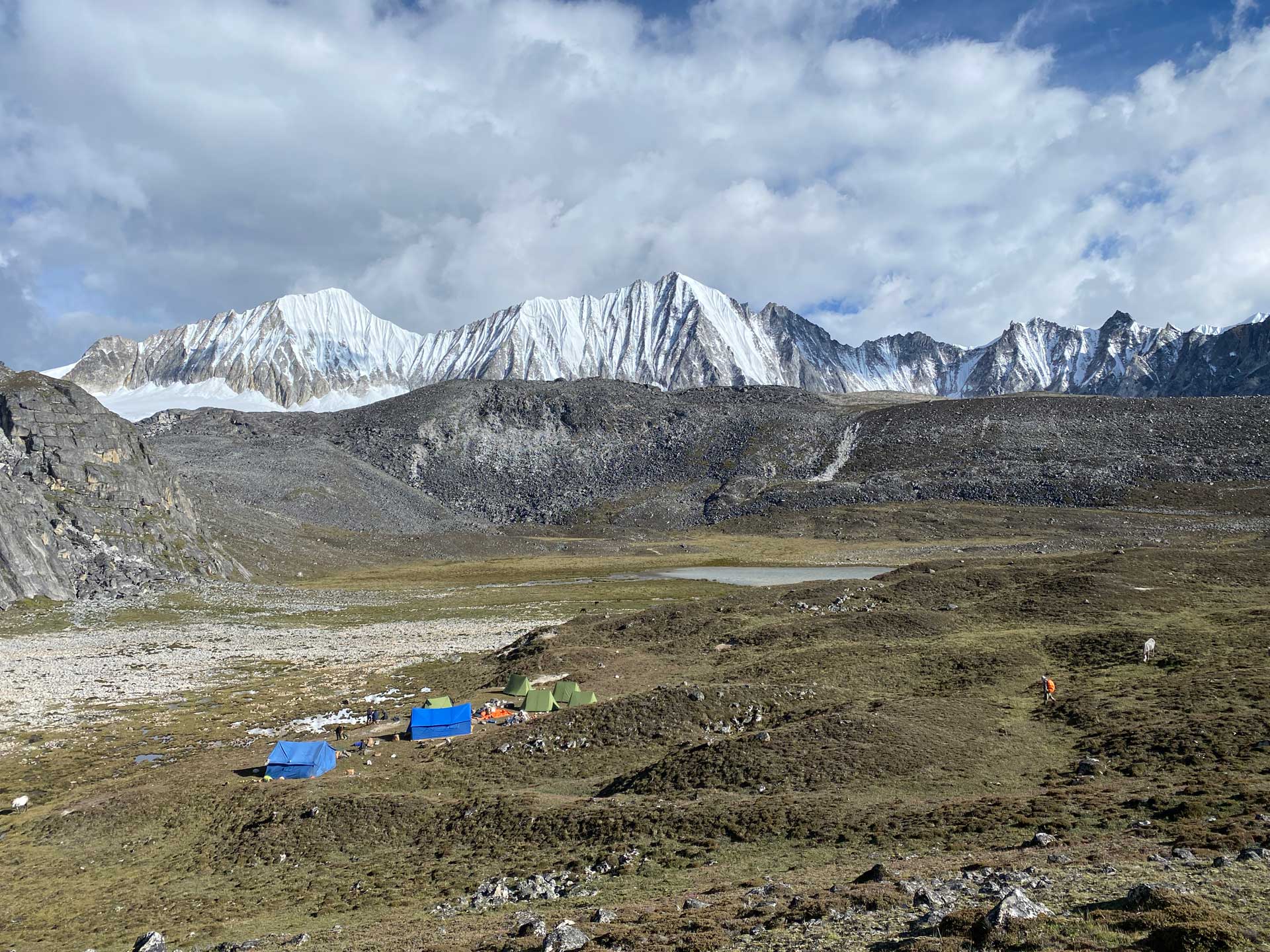
In the morning after passing a small army post, the we will gradually climb into a beautiful valley, winter home of yak herders. Lunch will be served in one of these huts. You will come across herds of yaks along the way. Our camp will be at Jangothang, literally meaning plain of ruins. Nearby, there are the ruins of an old fortress believed to have been used to guard Bhutan against Tibetan invasions. On a clear day, a short walk from the camp will bring you face to face with the majestic Mt. Jhomolhari.Altitude: 4115 m Distance: 15 Km Time: 5 – 6 hours
A rest day. A chance to acclimatize and walk up to the Tshophu Lake or to relax at the camp site.
We will have a good day’s walk ahead of us with spectacular views of the Jhomolhari, Jichu Drake and the Tserim Gang. We start climbing towards the first of several passes that we will cross along the trek. After some 3 to 4 hours, we cross the Nyelela pass (4,700 m) and then descend to our camp. We will get our first views of the Lingshi Dzong atop a hill.Altitude: 4000 m Distance: 17 Km Time: 6 – 7 hours
The walk today will be leisurely. Leaving Lingshi behind, the climb will be gentle and leads us to a delightful village, Gom Yu, which is set right below a 300 m cliff. Another hour’s walk brings us to the valley of Chebisa, with a huge waterfall at one end. We will camp by the side of the river.Altitude: 3780 m Distance: 12 Km Time: 4 -5 hours
We climb up to the Gokula pass (4,320 m) and then descend through forests of dwarf rhododendron towards our campsite near the riverbed. You will see some yaks and probably meet a few yak herders along the way.Altitude: 3890 m Distance: 17 Km Time: 6 – 7 hours
Today will be slightly strenuous. We will cross the Jarela pass at 4,640 m and then drop down through a forest trail to the Tsarigathang valley, where herds of Takin are seen in summers. We make a short climb up once again to reach Robluthang where we camp.Altitude: 4100 m Distance: 22 Km Time: 7 – 8 hours
This is one of the hardest days of the trek. We climb up to Shinchela pass at 4,870 m and are rewarded with stunning views of mountains, including the spectacular Gang Chen Ta at the head of the valley. On a clear day, practically all the mountains on the northern border are visible. Eagles, griffin vultures, blue sheep and yaks abound in this area. We descend down to camp on a lovely spot by the riverbank.Altitude: 4040 m Distance: 17 Km Time: 6 – 7 hours
We walk along the river, one of the tributaries of the Mochu and through a forest of rhododendron and silver fir and then enter the village of Laya. The people of Laya are culturally distinct in their beautiful vertical stripe yak hair clothing and conical bamboo hats. The women wear their hair long and with turquoise and jade jewelry. The rest of the day is spent at leisure or visiting village houses and meeting Layaps, as the people in Laya are referred to.Altitude: 3880 m Distance: 10 Km Time: 4 – 5 hours
We have a day at Laya to explore the place and meet local people.
The trail winds along the river valley, and you will be treated to breathtaking views of the river, feeder streams and waterfalls. Along the way, the trail branches into one going to Lunana (the Snowman trek, said to be the toughest trek in Bhutan) and one taking us to our campsite in Koena.Altitude: 3300 m Distance: 19 Km Time: 6 – 7 hours
We gradually climb up to Balela pass at 3,740 m and then descend to Gasa village. The first sight of the Gasa Dzong perched on the hillside over the village is an impressive sight indeed. There is a steep drop down to the river for an hour before we reach our camp near the Hot Spring an occasion for a good, hot soak!Altitude: 2638 m Distance: 15 Km Time: 6 – 7 hours
We will climb away from Gasa Tsachu, after which the trail winds through rolling hillsides of oak and pine. We will reach the village of Damji. From here, we will drive for two and a half hours to reach our hotel in Punakha.Altitude: 2280 m Distance: 21 Km Time: 7 – 8 hours
In the morning, we will visit the Punakha Dzong. The Dzong was built in 1637 and is an impressive display of Bhutan’s traditional architecture. In the winter, the monastic body moves from Thimphu to the Punakha Dzong. After lunch, a 3 hour drive takes us to the capital, Thimphu. On the way, we will drive over the Dochula Pass (3000 m) and to our hotel.
After breakfast, we will explore the capital. We will visit the National Memorial Chorten which was built in honor of our late King Jigme Dorji Wangchuck, the Textile Museum, the Folk Heritage Museum, the National Library, and the Handicrafts Emporium. We can also walk in the main street with its mixture of quaint little shops and larger shopping centers. After lunch, we will leave for Paro.
In the morning, our Chhundu representative will bid you farewell at the Paro airport.Good-bye and happy journey back home. Tashi Delek.


